Woods Mountain Trail
-
Address
-
Phone
-
Categories
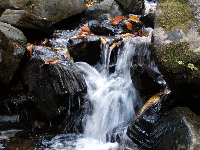
Hike or bike this one. It's not for the faint at heart! Elevation peaks at 3,600 feet opening to views of Black Mountains, Little Switzerland, Armstrong Creek Watershed and Table Rock from a section of the Mountains to the Sea Trail. This loop is over 26 miles. We suggest using an app, if you're directionally challenged, like the one offered on http://www.mtbproject.com/trail/3428297/woods-mountain-loop . This ride begins on Green Mountain Rd. across the street from USFS Work Center in Woodlawn, north of Marion, NC. There is also a large parking lot and a rest area adjacent to this trailhead on US 221. Just past the parking area and kiosk turn left at the gated road on the left. The Woods Mountain trail starts here and also shares designations with the the MST and some forest roads in places.
Stay on the main doubletrack for about a half mile and look for a right turn with MST white blazes. Turn here climb up and over Grassy Knob, and descend down to Tom’s Creek. Cross the creek on the left, opposite of the campsites and continue straight. This will dump you on FSR 1073 where the MST Woods Mountain heads left. Turn right on 1073 through the muddy sections to an open field where Harris Creek begins.
Harris Creek is a grunt and contains some bits that are too steep to ride for most riders. After 3 miles of up and down, you’ll pop out on FSR 469A. Take a right here and continue to a gate at the intersection of FSR 469.
Take a left on 469, which will take you to another gate in two miles. The next section is less gravel and more rural doubletrack. Continue on this and wind around through a beautiful section of forest. Take a left at the fork in the road where another gate awaits (its ~4.4 miles between these gates. Do NOT go right at this spot.
The last section of 469 is more overgrown with mixed surface conditions. The beginning is more of a field than a road, but it becomes more defined in places. 2 miles from this spot is where Bad Fork comes in on the left. VERY EASY TO MISS. Bad Fork is singletrack, and sweet, but a short stout climb up to the intersection with Woods Mountain.
Woods Mountain holds dual designation with the MST here, and for the most part is well maintained. Take a left, roll past the campsite, and start the hardest part of the ride, a climb/hike up Woods Mountain. Stay on the main trail. There are many unmarked intersections. Be sure to also read the separate description of this trail for more info.
Enjoy the amazing views on the way up, and take it all in. When you reach the summit, you’ll know because the main trail goes right and a long descent awaits from here.
Not many trails can boast a five mile descent, but this one is just that (sweet justice for the work to get there). 2000 foot of DOWN may rival any MTB descent, and this one will likely not disappoint.
The MST splits left at one point on the descent, but again, staying on the main corridor, you may fly right past it. The trail merges into FSR 104 at this point and rips down this all the way to the intersection with FSR 1073 near Old Toms Creek Rd. Take a sharp left through the gate at this spot and follow 1073 to where you popped out of the woods on the first pass. This is easy to miss.
At this point you'll be back in familiar territory and can start retracing your tire tracks back to Woodlawn.
Find More Hiking Attractions
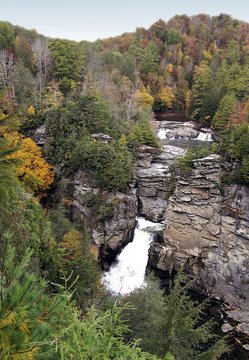
Linville Falls
Visit Linville Falls, an amazing three-tiered waterfall along the Blue Ridge Parkway. With many ways to access the falls, it is one of the most popular spots!

Linville Gorge Wilderness Area
Visitors to the Linville Gorge Wilderness Area in the Pisgah National Forest can enjoy primitive, strenuous recreation in a wild and isolated terrain!
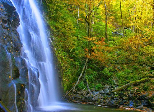
Crabtree Falls
The hike to the gorgeous Crabtree Falls waterfall in Little Switzerland is on a moderate 2.5 mile trail. It is located right off the Blue Ridge Parkway!

Historic Orchard at Altapass
The Historic Orchard at Altapass in Little Switzerland is a must-visit from May through October! Experience music, hay rides, treats, storytelling and more!

Bad Fork
2940 Ft. /8 Miles. Primitive trail connects Woods Mountain & Armstrong Creek Trails. NC 226-A to Armstrong Fish Hatchery Rd.…

Betsy Ridge
3160 Ft./9 Mile Trail. Black Mountains view, meets Little Buck Creek Trail ending at Woods Mountain Trail. US 221 North,…